
|
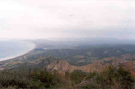
North Beach (or Ocean Beach), looking north towards Suvla Bay. 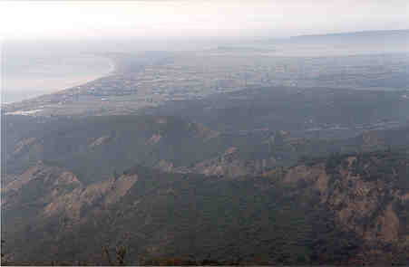 This was the view the New Zealanders and Australians had of the British during the attacks in August. The Anzacs could see quite clearly the British sitting down doing nothing for two days while they were being killed at Chunuk Bair and Lone Pine. Later, the Anzac watched again as the British were slaughtered by the Turks when finally the British did try to make an attack, which then failed. Suvla Bay is straight ahead in the distance. On the left is Ocean Beach, or North Beach as it was sometimes called. In the middle is the Salt Lake, which dries up in the summer. |
|||
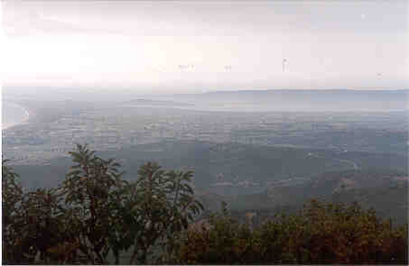 After sitting on the beach for two days, the British officers formed up the soldiers and marched them in straight lines across the dried up lake bed. The Turks had got ready with machine guns and artillery, and as the British advanced they were shot down and slaughtered. Soon, large parts of the scrub and bush caught fire and burned alive many of those men who were wounded and couldn't get away from the flames. Those who escaped said they could hear the screams from the wounded men as they were burned alive, and smell the skin and flesh burning. The Salt Lake is clearer in this picture. It is only formed in the winter when rain from the hills runs down and gathers as a lake before soaking into the ground. this leaves the ground and water very salty. The British soldiers said it was too hot after they landed and they needed more rest and water before going on. They then waited for two days to get ready. |
||||
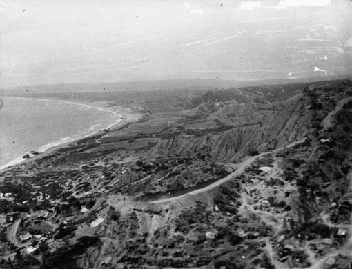
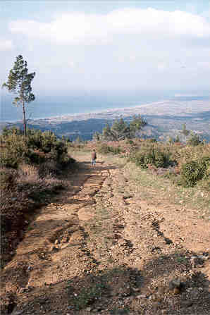 North Beach, or Ocean Beach is at the bottom of this ridge, running up to Suvla Bay. The bottom of this ridge was the limit of the fighting, as the Anzacs never managed to get any further up the beach. All travel to Suvla Bay had to be done by boat as it was too dangerous to try to travel along the beach. Looking down Rhododendron Ridge to Ocean Beach. Suvla Bay is away to the right. The grooves in the steep track have been made by the heavy rain Gallipoli gets. This heavy rain keeps uncovering bones from the long dead soldiers of 1915. Chunuk Bair is at the top of this track up Rhododendron Ridge. |
||||
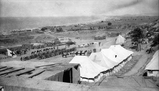 (Alexander Turnbull Library, PA11-194, C 10044) You can see a line of mules walking through the middle of the picture. The mules were used to carry men and stores all around the whole Anzac area. Today, the Canterbury Cemetery is very close to this spot. Suvla Bay is in the distance. On the beach there were two outposts where the soldiers had captured some Turkish positions. This one was called Outpost Number 2. A small hospital was built here under the shelter of the hills. Some hospital tents have a red cross on them. This helped New Zealand and Australian soldiers to find them, and also to let the Turkish soldiers know that these tents were being used to help the wounded and sick. The Turkish soldiers were very good and tried hard not to attack any hospital tents. |
||||
 This looks up towards Suvla Bay, across the steep valleys, called Deres in Turkish. Ocean Beach is below. This spot on the beach is very close to where the two wrecked cutters are in the picture below. Today, the Canterbury Cemetery is below here on the beach, just out of the picture. |
||||
 (Alexander Turnbull Library, PAColl 3051, G 9373) Walker's Ridge went from the beach up to Russell's Top. Very quickly a track was built on it so that stores could be moved up to the firing line. The Wellington Terraces are just in the corner on the bottom right, and the track is above them, winding up to Russell's Top. This is looking to the north, so the beach was called North Beach (or Ocean Beach) and looks away to Suvla Bay in the distance. Two wrecked landing boats (cutters) are lying washed up on the beach. |
||||